Land Use and Land Status
See how each area of interest is used, and how much of it is vegetation versus bare soil, on any capture date.

Skeye helps insurers understand the land and assets they cover before a policy is issued, and confirm what happened after a claim is made, using AI on satellite imagery.
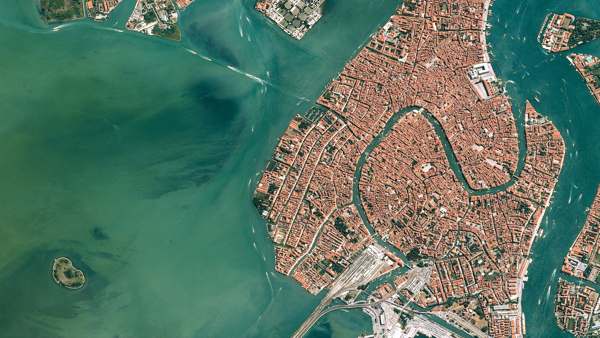
Before a policy is issued, insurers need to understand what they are covering: how the land is used, how healthy the vegetation is, what stands on the site and how all of that has changed over the years.
After an event, when a policyholder makes a claim, insurers need to confirm what happened, where and how much of the insured area was affected, often without sending an assessor out straight away.
Skeye supports both, from the same satellite imagery and without your team needing GIS or remote sensing expertise.
Build a clearer picture of an insured area before you price it.
See how each area of interest is used, and how much of it is vegetation versus bare soil, on any capture date.
Look back across past captures to see how a site has changed, from new construction to cleared vegetation.
Detect and count objects such as swimming pools, solar panels, parking lots, vehicles and trees to check what is actually there.
For agricultural cover, follow vegetation health (NDVI) across seasons to understand how a farm normally performs.
Check a claim against what the imagery shows, before and after the event.
Compare imagery from before and after a flood, fire, storm or drought, side by side, for the claimed area.
See which parts of the area of interest changed, such as vegetation loss or newly bare ground, and how much of it was affected.
Prioritise site visits for the claims that need them and settle clear-cut ones sooner, with imagery to support each decision.
Deliver results through the Skeye API as structured data, straight into your underwriting and claims tools.
Send us the insured areas or policy locations, or draw them on the map.
We analyse past and current imagery for each area: land use, vegetation, objects and change over time.
When a claim comes in, Skeye compares imagery from before and after the event date for that area.
Your underwriters and claims handlers see the results per area, ready to use or to feed into your own systems.
Any cover tied to land or outdoor assets, including agricultural and crop insurance, property, and natural catastrophe cover such as flood, fire and storm.
It depends on when a clear satellite capture of the area is available after the event. Cloud cover can delay some captures, and we will be clear about the dates each result is based on.
Our AI models average 98% accuracy on most satellite images. Some conditions can lower this, and we work with you to bring it back up. We can measure accuracy on your own portfolio before you rely on the results.
Yes. You can analyse your own imagery or use the Skeye image library.
No. Skeye gives underwriters and claims handlers results per area that they can read straight away.
Tell us about the risks you cover and the claims you handle, and we will show you what satellite insight can add.